

Alta Via 1 of Dolomites
The Alta Via 1, or “AV1” is a 8-10 days hike across the Italian Dolomites. With its incredible network of mountain huts, Italy offers multiple long-distance traverses called Alta Vias. As more hikers share their stories, the Dolomites is quickly becoming Italy’s most popular hiking destination.
110km
distance on trails
7,000m
vertical ascent
2,752 m
Rifugio Lagazuoi, highest point of the hike
Alta Via 1 trek itinerary day-by-day
The AV1 is the easiest in the series of Alta Via treks while our AV2 is more challenging, still without the need for any “via ferratas”. Enjoy July in the mountains with incredible range of wildflowers, or early September after the local holidays.
Day 1 The Jewel of the Dolomites

Arrival day
Meet your guide and group in Cortina
You’ll make your own way to the beautiful town of Cortina d’Ampezzo, easily accessible from Venice airport by bus. Arrive in plenty of time to explore Cortina, it is a quaint town with stunning surroundings. It is known as the jewel of the Dolomites. Here you will check in to the Hotel Menardi (or hotel of a similar standard), a family owned hotel just off the main streets of Cortina. Enjoy relaxing here or head out to explore the town before dinner.
Your will meet your guide and group before dinner at 6pm in the lobby, you will have a briefing about the trip then we will get to know each other over a great meal at the hotel.
Then it’s time for a good nights rest before the start of your hike tomorrow!
Day 2 Dive right in
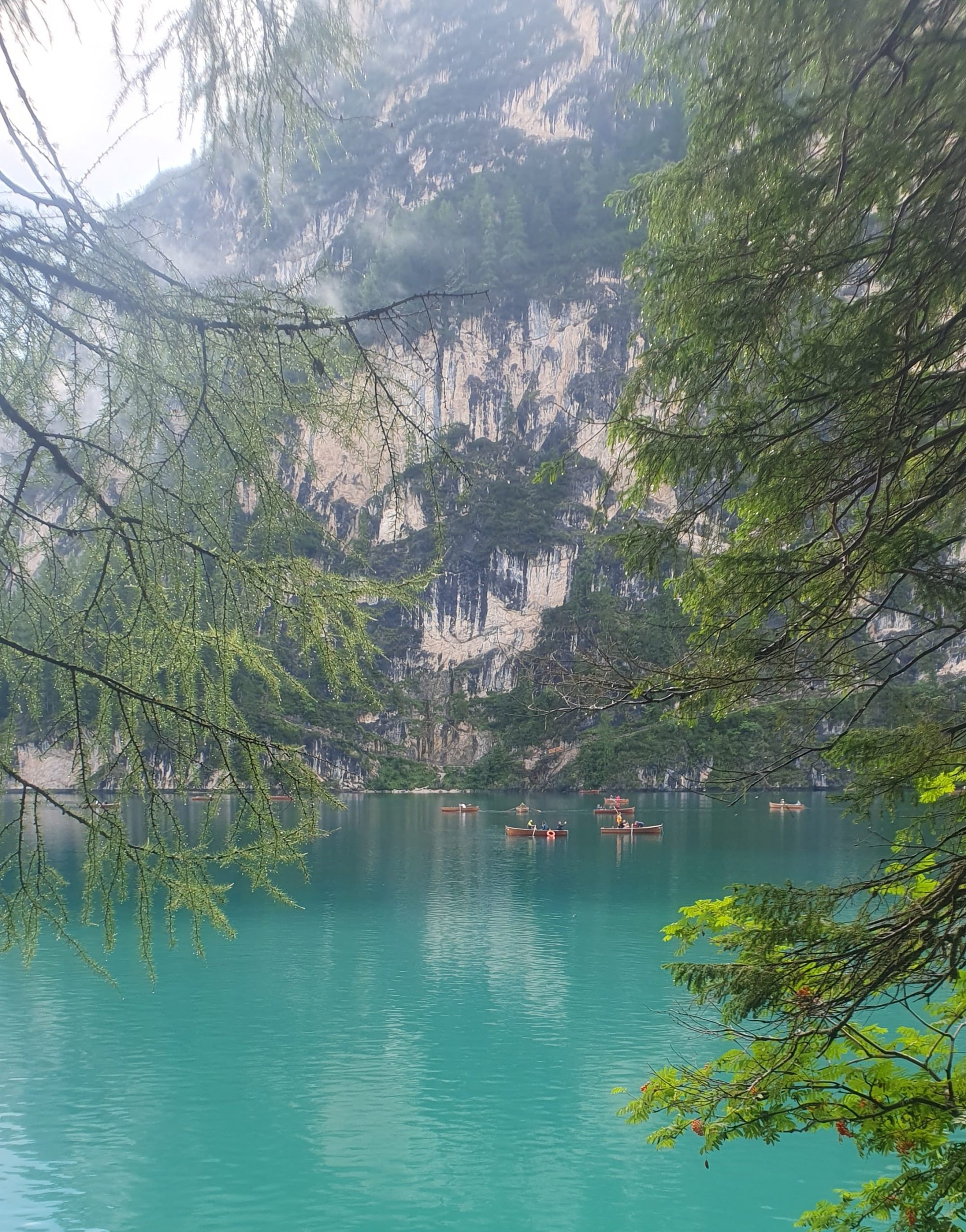
Lago di Braies (Pragser Wildsee) > Pederü
The day will start with a short taxi ride from your hotel to the starting point of the hike, the famous Lago di Braies (Pragser Wildsee). After a quick photo or two you’ll escape the crowds and start the first climb of the day, on the opposite side of the lake. The path is steady but never too steep, with great views of the lake below. A short exposed section will lead to a pass at 2400m, just above Rifugio Biella, a nice location for a quick lunch break.
The rest of the stage continues easily along wide and smooth tracks across open terrain. You will pass Rifugio Sennes, a great opportunity to stop for a cup of coffee and a slice of cake. It’s all downhill from here, and after one last steep section you’ll reach Rifugio Pederü. You will spend the night here or take a short shuttle to the quaint resort of st Viglio for the night.
The first section of the hike is in the National Park of Fanes, Sennes and Braies
Today you have hiked 14,8km with 1029m of climbing
Day 3 Sheer Cliffs and Amazing Views

Pederü > Rifugio Scotoni or Rifugio Lagazoui
Start the day by climbing up through the forest and on good paths all the way to Rifugio Fanes, a great spot for a morning coffee. From here you will continue on forest roads and paths all the way to the main Fanes plateau, you will pass Lago di Limo and continue to climb gradually to the Forcella del Lago (2486m), a very narrow mountain pass. The descent from here is not to be underestimated, the path is very good but also very steep and the terrain loose, so concentration is required. Once at the bottom of the descent you’ll have some time to relax by the shores of Lago Lagazuoi. From here take a short hike to the refuge for the night, the cosy Rifugio Scotoni or continue to Rifugio Lagazuoi.
Today you have hiked 15,1km with 1103m of climbing (3km extra to Lagazuoi)
Day 4 On Historical WWI Paths
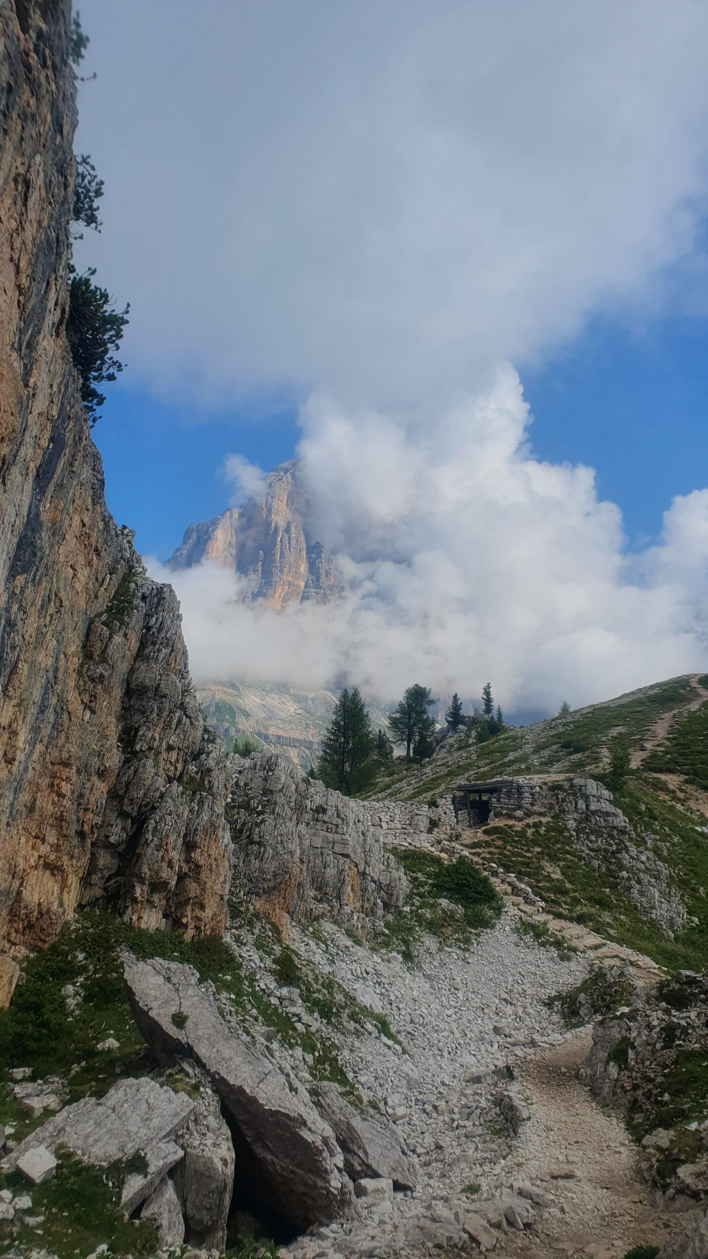
Rifugio Scotoni > Rifugio Scoiattoli
From the hut you will ascend to the stunning Lagazuoi, a view point for the whole Dolomites! From the hut you’ll traverse the high balconies of rocky cliffs to the Rifugio Dibona before descending to cross the valley and climb up to Cinque Torri mountain peaks.
There is an open air Great War museum here with restored Italian military base with it’s trenches, machine gun posts and bunkers. Take a break to explore the history and look for climbers on the famous five towers before heading on to your refuge for the night.
Today you have hiked 11 km with 1100m of climbing
Day 5 The heart of the Dolomites
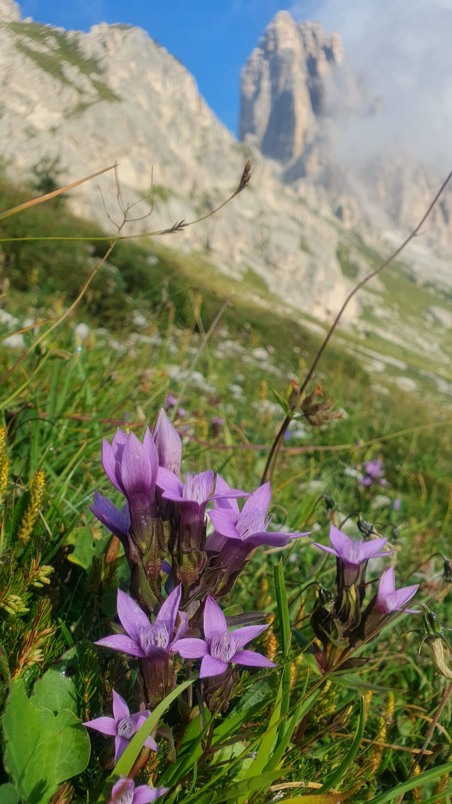
Rifugio Scoiattoli > Passo Staulanza
After a mandatory sunrise on the terrace (if the weather allows) and a good breakfast, we’ll start descending all the way to Passo Giau, another busy mountain pass with lots of cars, motorbikes and bicycles. After crossing the road all this will disappear once again and you’ll start walking on a beautiful but slightly more technical section of the route. After tackling a few rocky steps and a steep but short uphill section you’ll get to Forcella Giau, quickly followed by Forcella Ambrizzola and Forcella Col Duro.
You’ll then descend to the other side on a wide gentle track to reach Rifugio Città di Fiume, a lovely spot for a cup of coffee and a break before the last section of the day. To reach our final destination at Passo Staulanza we have one last traverse at the foot of Monte Pelmo, one of the most impressive mountains in the Dolomites and the first to be climbed by Irish mountaineer John Ball. After a few rocky steps and a steep muddy descent in the woods you’ll reach the road and your hut for the night.
Today you have hiked 17km with 600m of climbing
Day 6 The wall of all walls
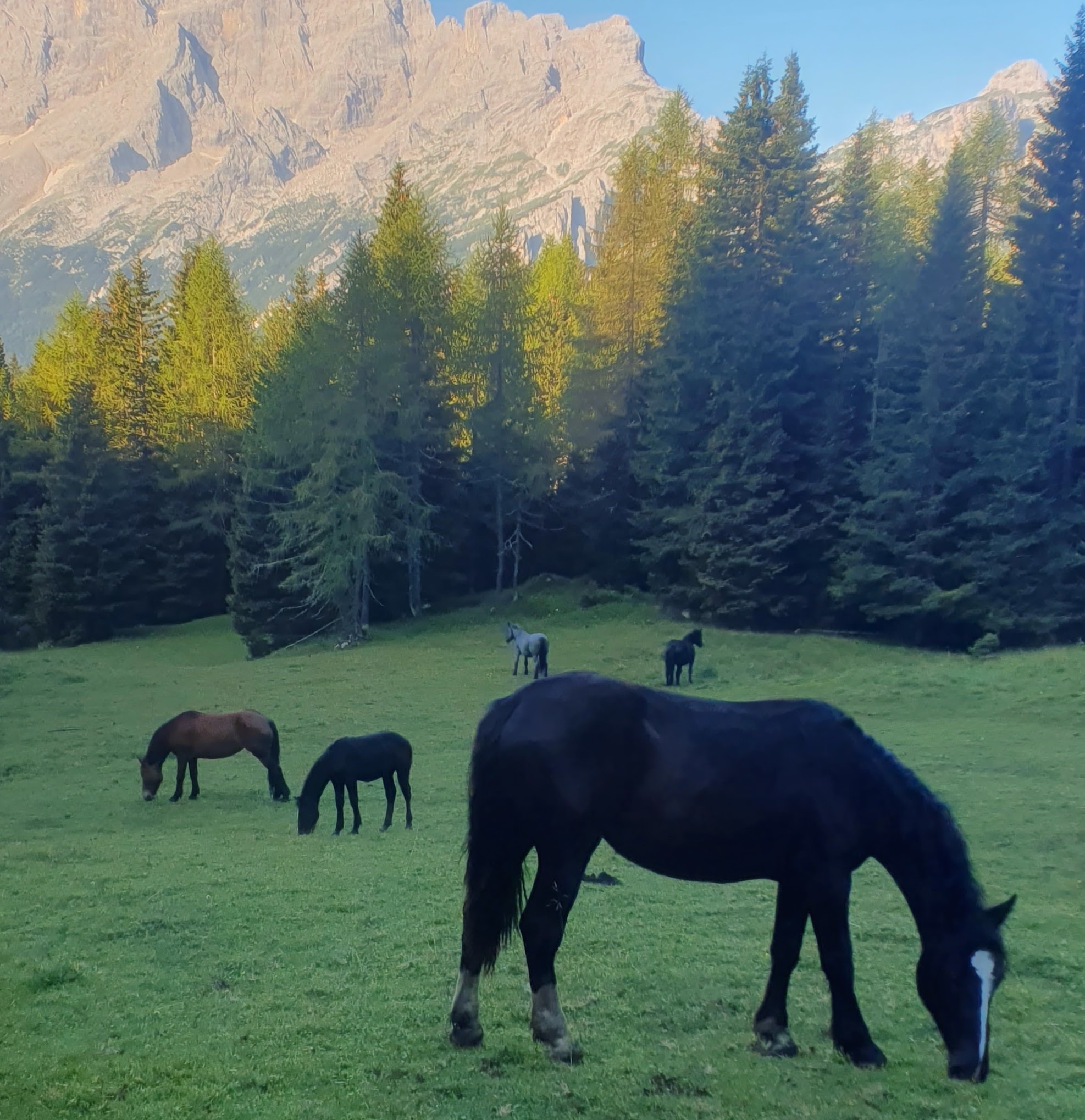
Passo Staulanza > Rifugio Vazzoler
Today is a beautiful but also challenging day, not to be underestimated. From Passo Staulanza you’ll walk along a short road section followed by a wide forest road. The path will quickly get steeper, though, and lead you to the very scenic Rifugio Coldai, just above 2200 metres. After a mandatory coffee and a break you will continue to the beautiful Lago Coldai and along one of the most famous mountains in the Dolomites: Monte Civetta. Its north-west face, that you will follow in its entirety, is one of the most iconic faces in the whole region, an outstanding sheer limestone cliff rich in mountaineering history. For this reason it’s otherwise known as “the wall of all walls”.
Try not to look too much at it, though, as the path requires attention. It’s quite rocky in places, which might slow you down a little, but I promise you won’t be in a rush to get away from this place! Once you reach the end of the north-west face of Civetta you’ll join a wider track that will lead you quickly to Rifugio Vazzoler, your home for the night. Here the best atmosphere on the AV1 is guaranteed!
Today you have hiked 15km with 950m of climbing
Hike the Alta Via 1 with us
July 10th and September 4th 2026 guided groups
Day 7 Discover the Backcountry

Rifugio Vazzoler > Rifugio Tomé
Leaving Rifugio Vazzoler is always hard, but another beautiful day awaits. You’ll start the day by loosing some height, walking on a 4×4 track leading towards the valley. Before too long, though, you’ll take a side path underneath the cliffs of the Moiazza mountain range, the continuation of the Civetta range. This section goes from steep muddy paths to boulder fields and scree slopes, and it definitely requires some care, attention and patience. After one last exposed section between Forcella Col d’Ors and Forcella del Camp (not ideal for those who feel uncomfortable with heights), the path easies off a bit and traverses over to Rifugio Carestiato.
Enjoy a break here before the last easy section to Passo Duran and Rifugio Tomé, our very cosy overnight stop.
Today you have hiked 10km with 675m of climbing
Day 8 The wild side of Dolomites

Rifugio Tomé > Rifugio Pian de Fontana or Rifugio Pramperet
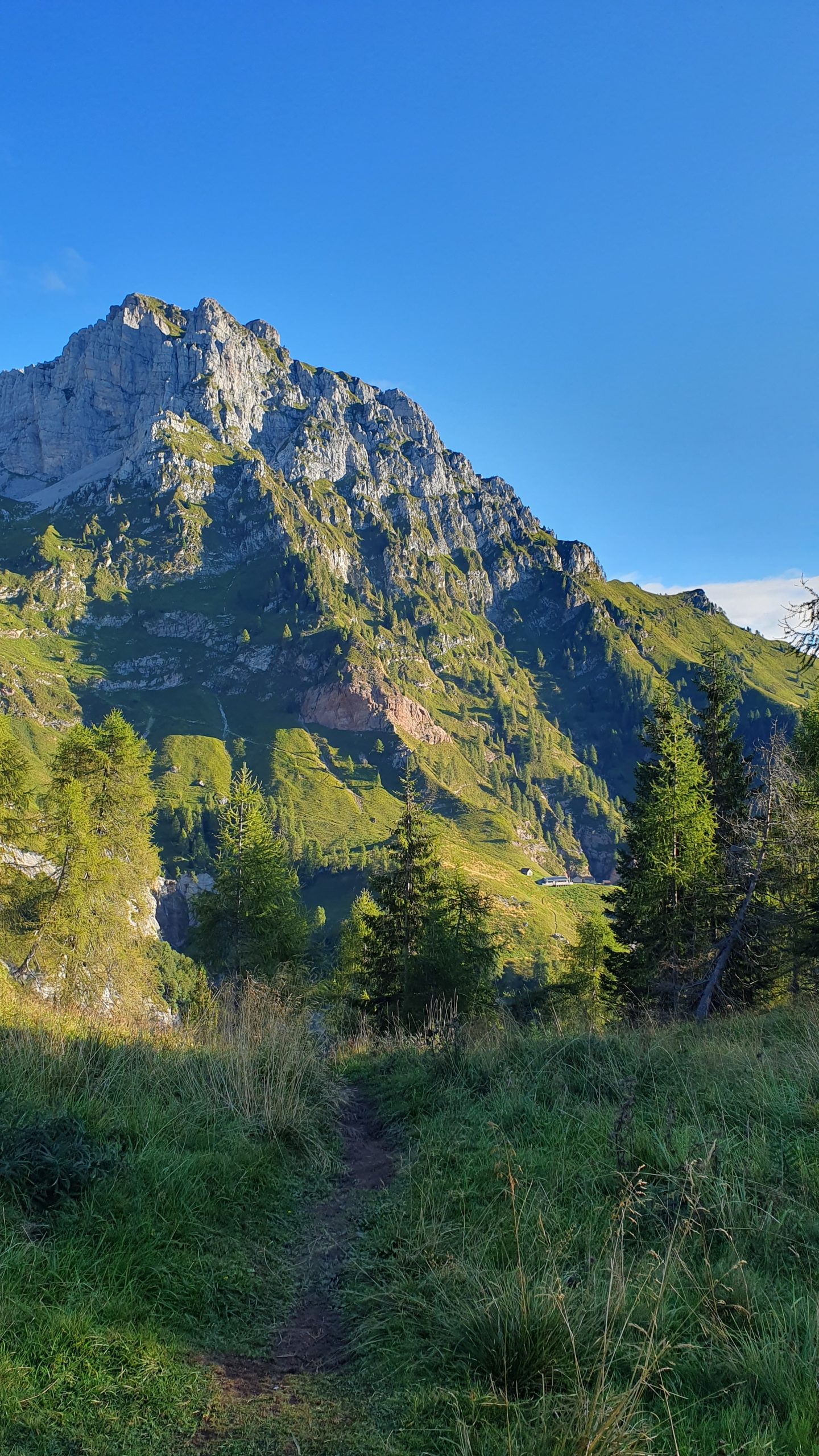
Today we enter the Dolomiti Bellunesi National Park and we’ll notice a change of scenery. Although the big limestone walls are still there, this side of the Dolomites is much wilder and feels more remote than what we’ve just crossed. After a short road section you’ll enter the woods and walk through beech trees, before reaching the tree line and hiking across the open slope to Rifugio Pramperet. This is a beautiful place and a great spot for a breakand admire the views over the Belluno National Park mountain peaks.
From here you’ll start the main climb of the day to Forcella de Zita Sud, where a beautiful wild valley will open in front of you. Keep your eyes open here, it’s wildlife territory! From the pass you’ll start your descent down to the hut, which is reached after a very steep section. Normally we will stay at this tiny refuge but occasionally we will continue along the trail to Rifugio Bianchet.
Today you have hiked 16km with 1150m of climbing
Day 9 Back to civilisation
Rifugio Pian de Fontana > La Pissa
From Pian de Fontana you’ll have a short descent followed by one last climb to a col, which will warm you up on the last morning. From here you’ll start the long descent down to the valley which will take you past Rifugio Bianchet, one last chance for a mountain coffee. After this the path becomes wider and will lead you down to the main valley road, where a transfer will be waiting (with any bags you stored during the hike). From here you can head back to Venice Marco Polo airport or be dropped off in the mountain town of Belluno if you intend to extend your stay.
If you intend to fly out on the same night- you will reach the airport by around 5.30pm on the final day of the hike.
Today you have hiked 11km with 400m of climbing – or 17km from Rifugio Pramperet
Hike the Dolomites next summer with us
Dolomites FAQ: How to prepare, what to bring?
Additional Happy Tracks services
Luggage services
Store one bag in Cortina during the hike and get it delivered to our end point on the final day. Please get in touch about the cost.
Many of the refuges are difficult to access by road, so luggage transfer is not available as standard for this tour. We can arrange this at an additional cost, please enquire in advance for the cost and availability.
Accommodation
On the first day of this tour, you’ll stay in a comfortable 3 star hotel in Cortina. The rooms are twin rooms, so if you plan to travel alone, you’ll share with another hiker from the group (of the same gender if possible).
For the rest of your time on the AV1, you’ll stay in remote mountain refuges. Here the accommodation is in small, mixed dormitories, which are comfortable but not luxurious. Staying in a mountain refuge is part of the real hiking experience. The views and scenery are spectacular, and you’ll have the opportunity to meet other hikers. You’ll stay in bunk beds with pillows and blankets (a thin, light sleeping bag liner is mandatory for hygienic reasons) For more information about mountain refuges, read this blog post.
What to expect on a guided Alta Via 1 hike?
Join a guided Alta Via 1 hike and you will…
- Traverse the Dolomites, passing some of its most famous mountains;
- Hike 110 kilometres through ever changing scenery and terrain, from green pastures to sheer limestone drops;
- Tackle some challenging sections and reach a height of 2750 metres;
- Immerse yourself in the region’s alpine culture, history and wildlife;
- Sleep in some of the most welcoming and remote mountain refuges in the region;
- Taste some of the best mountain food in the Alps;
- Gain interesting knowledge from a local guide.
How difficult is the Alta Via 1?
The trails on the Alta Via 1 are never too technical. Because of this, the AV1 is the perfect hike for anyone wanting to experience long-distance hiking in the Dolomites for the first time. That said, there are some steep, exposed sections on very rocky paths and the days are challenging (see below for the day-by-day statistics). You should only hike the Alta Via 1 if you have a decent level of fitness, and you should have some experience hiking in the mountains. If you’ve already hiked the Tour du Mont Blanc, the Alta Via 1 will feel like a natural step up.
Do I need hiking / trekking experience?
The Alta Via No. 1 is suitable for fit and experienced hikers who exercise on a regular basis. Previous trekking / multi-day hiking experience is not a must, but an advantage. Having hiked outdoorsa in the past you should be able to hike 1000m of ascent and 18km distance per day on mountainous terrain. Count in that you will hike with your backpack (incl. full kit for the tour) unless you have booked luggage transfer.
How can I get prepared?
To get prepared for a hiking adventure like the Alta Via No. 1 any endurance training is suitable. Exercises like running, walking, cycling etc. are good. It is also important to get used to your hiking boots and to your backpack (with weight!). Try to break them in and to get a comfortable feeling. Even a round in the park every now and then helps to find out if your boots or pack are comfortable.
What do I need to bring for the Alta Via 1?
You can download our packing list here. Depending on the time of the year of your journey some items might not be necessary (beanie, gloves etc.). If you strictly follow the packing list, you’ll be prepared for every situation and your backpack won’t get too heavy. You should aim for no more than 10kg on your back, otherwise it will get tough! We have also created a blog post, to explain a few tips & tricks.
How to prepare, what to bring?
Read our Alpine trekking FAQs written by our local guides. See also our detailed TMB packing list that is useful also for the Alta Via 1.
Food during the Alta Via 1 hike in the Dolomites
You’ll have plenty of opportunities to try a variety of local specialities. All the refuges offer breakfast and a three-course dinner. The breakfast contains coffee and tea, bread, butter and jam. Some of the less-remote refuges also serve orange juice, cereal, yoghurt, fresh fruits, cheese and meat. The three-course dinner is hearty and the portion sizes are quite big. A typical menu would be :
- a pasta or a vegetable and pulses soup for starter
- a main course of meat, vegetables and a carbohydrate-rich side dish (e.g. potatoes. or polenta)
- a simple dessert, such as vanilla pudding or a fruit salad
Tap water is offered free of charge, and you can buy supplementary drinks (e.g. coke, wine, beer). You can pay for the supplementary drinks in the evening before going to bed.
We will provide you with a lunch pack for each day. A typical lunchpack will consist of a sandwich, some fresh fruit, and some snacks (e.g. nuts, muesli bars).
If you have any food restrictions (vegetarian, vegan, gluten intolerance etc.) please let us know as soon as possible. We can cater for most dietary requirements, but please note that some villages have very small shops, so the choice is often limited. Mountain refuges can also cater for most standard allergies / intolerances, but again the choice may be limited.
Weather in the Dolomites
Summers in the Dolomites (June – September) are usually fair and quite warm. It is often sunny and the temperatures can reach up to 30° Celsius, although it is a dry heat. The weather in the mountains can be unpredictable, and meteorological situations can change very quickly. Therefore, it is necessary to be prepared for such a change.
Another factor to consider is that you will be hiking in different altitude levels. Because of this, you’ll experience significant temperature changes; hiking in the the valleys and forests will feel much warmer than the mountain passes.
On a rainy day, temperatures can drop quite low and it is necessary to have a good rain jacket. We also recommend bringing a hat and a pair of gloves.
We will send you a detailed packing list ahead of your trip. If you stick to list, you will be prepared for any weather situation. Please do not hesitate to ask us if you have any questions about this (or any!) topic.
Insurance for your trip
From the moment you start the trekking we highly recommend you have a valid travel, medical & mountain evacuation insurance. Organise your insurance before the tour starts. This is essential because mountain rescue can be very costly. You could face paying several thousands of euros, especially if a helicopter rescue is necessary. The cost of hospitalisation is normally the most expensive part if you do not have the correct cover. It is your responsibility to take out the correct level of insurance, and we accept no responsibility for any costs that occur as a result of inadequate insurance. However, if you have any questions about this topic or if you need help choosing insurance, please do not hesitate to contact us.Read our Alpine trekking FAQs written by our local guides. See also our detailed TMB packing list that is useful also for the Alta Via 1.
More about Dolomites
The Dolomites are a mountain group of the Southern Limestone Alps, but are also included in the Southern Alps. They are divided between the regions of Veneto and Trentino-Alto Adige in Italy and – in roughly equal parts – the provinces of Belluno, Bolzano-Alto Adige and Trento. Since 2009 parts of the Dolomites have been included in the UNESCO World Natural Heritage Dolomites. The highest mountain in the Dolomites is the Marmolata at 3343 meters above sea level. Other famous peaks or massifs are the Civetta, Monte Pelmo, Tofana de Rozes, 5-Torri, Croda da Lago, Schiara and many more.
The Dolomites emerged as a Ladin language area from the migration of the peoples, but with the emergence of Tyrol and the incorporation of Trentino into the Holy Roman Empire from the Middle Ages onwards, they were partly Germanised by Bavarian settlers.
In the 18th century the mountains were still called “pale mountains” or “monti pallidi”. The name ‘Dolomites’ spread after the predominant rock was given the name dolomite, in honour of the French geologist Déodat de Dolomieu (1750-1801), who was the first to analyse its composition.
The Dolomites were the border between Germany, Austria and Italy throughout the High and Late Middle Ages and until the Napoleonic era. Between 1866 and 1918 the Austrian-Italian border also ran through here.
WW1 History along the Alta Via 1
During the mountain war of 1915-1918, when Italy fought on the side of the Entente in World War I, the border was a mountain front. However, the Italians only succeeded in occupying Cortina and parts of the Dolomites in the course of their offensive, so that once the front had been stabilised it ran from the Passo San Pellegrino via Marmolata, Col di Lana, Lagazuoi, the Tofanen, Hohe Gaisl, Schluderbach, Monte Piana, Drei Zinnen and Paternkofel to the Kreuzbergsattel. In many places, traces of war can still be seen, especially the Col di Lana summit, which was brought down by blasting.
Along the Alta Via 1 route, you’ll pass some remains from World War 1. Rusty barbed wire, deep trenches and ruined barracks are fairly common sights in the Dolomites. They remind us of the tragic past, when the area became a war zone and contested borders ran along the peaks and ridges. These landmarks are both humbling and interesting!
Get in touch for bookings or to organise your own private hike
The hikers Newsletter
Get trekking info and our latest deals.
