

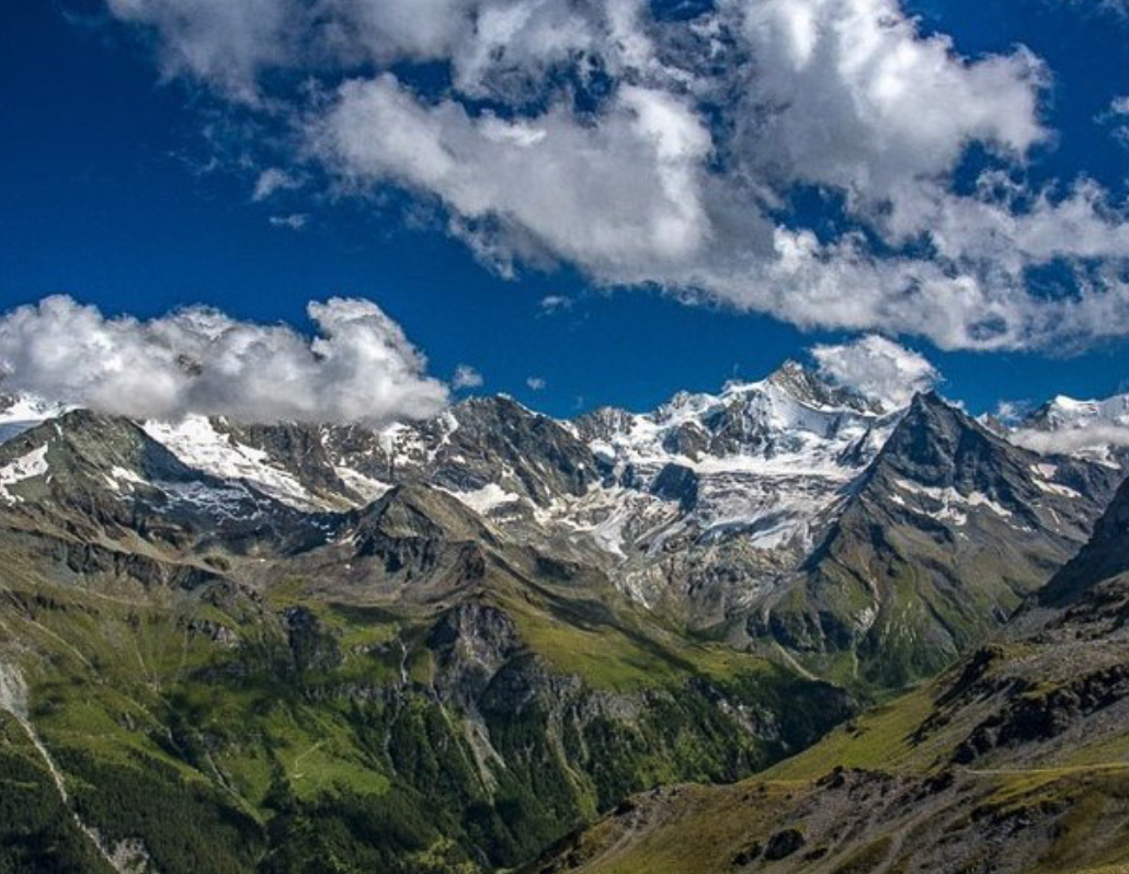
Walker’s Haute Route: The Highlights and Insider Secrets for the Chamonix to Zermatt trek
Discover Walker’s Haute Route from Chamonix to Zermatt with this locals' guide to the daily trail highlights, local food, and hidden alpine secrets.

Thinking about tackling the legendary Walker’s Haute Route? Stretching from the shadow of Mont Blanc all the way to the jagged tooth of the Matterhorn, it is arguably the most spectacular multi-day trek in Europe. Read our Guide to the Haute Route here.
Whether you are laced up and ready to go or just daydreaming from your desk, here is info from our guides to this ultimate trek. Discover where the hidden border markers are, why a lake turns neon blue and the eerie reason a whole Swiss village packs up and vanishes every autumn. This itinerary is based on how we hike our Guided Haute Route.
Day 1: Argentière to Trient
- The Big Highlight: Aiguillette des Posettes. Standing at the top gives you a jaw-dropping, 360-degree split screen: the dramatic Emosson Dam in one direction, and the massive, ice-capped Mont Blanc range in the other. It is the perfect, panoramic welcome to the high Alps.
- Culinary Highlight: Tarte aux Myrtilles (Blueberry Tart). Make sure to stop at the historic Refuge du Col de Balme just as you reach the ridge. Sitting on the terrace with a slice of their classic, rustic wild blueberry tart while staring back at the entire Mont Blanc massif is an alpine rite of passage.
The Hidden Fact
As you cross the Col de Balme, you officially walk out of France and into Switzerland. Keep your eyes peeled near the historic refuge. Scattered around the pass are old stone boundary markers dating back to the 19th century. If you look closely, one side is carved with an ‘F’ for France and the other with a ‘V’ for Valais (the Swiss canton). You are literally stepping through European history.
Day 2: Trient to Champex-Lac

- The Big Highlight: Fenêtre d’Arpette (The Arpette Window). This is a proper, high-mountain pass. You scramble up a harsh, gray glacial moraine, squeeze through a tight notch in the cliffs, and BAM—the landscape instantly flips into a lush, vibrant green paradise as you look down into the Arpette Valley.
- Culinary Highlight: Valaisanne Apricot Tarts. Once you negotiate the boulder field and drop into the peaceful Valais countryside, keep an eye out for Gentiana bakery featuring Luizet apricots. This specific variety only thrives in the sunny Valais microclimate and makes for the juiciest, sweetest post-hike reward.
The Hidden Fact
The massive boulder field right below the “Window” isn’t just a random pile of rocks; it’s an active rock glacier. Unlike ice glaciers, these are massive rivers of debris held together by permafrost deep underneath. It moves incredibly slowly—just a few centimetres a year—meaning the exact path you step on is technically shifting beneath your boots.
Day 3: Verbier to Cabane Prafleuri
- The Big Highlight: The Grand Désert. After tackling two high passes, you drop onto a vast, eerie, limestone plateau. It feels less like Switzerland and more like the surface of the Moon, completely carved out by a retreating glacier.
- Culinary Highlight: Rösti. After crossing a barren, rocky landscape, walking into the cozy warmth of Cabane Prafleuri calls for ultimate Swiss comfort food. Order a skillet of hot, crispy, buttery Rösti—shredded pan-fried potatoes topped with a fried egg and a mountain of melted local cheese.
The Hidden Fact
When you finally reach Cabane Prafleuri, you’ll likely spot alpine ibex grazing nearby. What most hikers don’t realize is that the cabin itself is built on the site of an old quarry. The gravel and rock used to build the nearby Grande Dixence Dam (the tallest gravity dam in the world) was dug up right here, which is why the surrounding terrain looks so strangely terraced.
Day 4: Cabane Prafleuri to Arolla
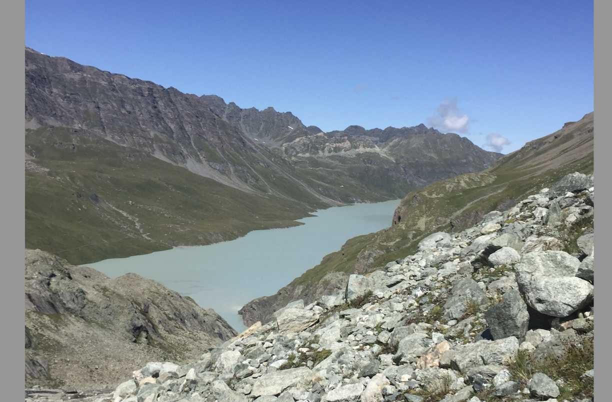
- The Big Highlight: The Glacial Silt and Boulder Valleys. This stage delivers a stark, raw encounter with ancient geology. You hike beneath an impressive, almost vertical band of rock and navigate wide valleys filled with unique glacial silt and massive erratic boulders left behind by a retreating glacier.
- Culinary Highlight: Assiette Valaisanne (Valais Platter). When you roll into the quiet mountaineering village of Arolla, track down a local sun terrace and order a traditional platter. It’s a gorgeous spread of air-dried mountain beef (Bündnerfleisch), spicy rye bread, and local cured ham that pairs perfectly with a glass of crisp, white Fendant wine.
Important Trail Update: You might read older guidebooks mentioning a series of vertical iron ladders at the Pas de Chèvres to cross this ridge. Due to significant rockfall and shifting rock faces, these ladders have been permanently closed. See the official Swiss map here. The route now takes a spectacular, rugged mountain detour over the Col de Riedmatten, offering a classic, hands-on alpine scrambling experience.
The Hidden Fact
Before you begin your climb, you’ll walk along the flat, glassy edge of the Dixence Reservoir. If you peer into the milk-green water on a clear day, you are looking over the remnants of an entire underground military infrastructure. During the Cold War, Switzerland built massive, hidden military pumping stations and tunnels inside these mountains, entirely out of sight.
Day 5: Arolla to La Sage

- The Big Highlight: Lac Bleu. A brilliantly vivid, neon-blue pool tucked into the upper limits of the forest. It’s the perfect place to kick off your boots, dip your toes, and grab a coffee at the charming lakeside hut.
- Culinary Highlight: Homemade Alp Kiosk Baking. The tiny wooden refreshment hut right next to Lac Bleu is legendary among walkers. Grab a seat on the wooden benches and ask what’s fresh—they regularly bake simple, incredible rustic cakes using local mountain dairy butter and seasonal berries.
The Hidden Fact
Everyone remarks on the water’s unreal color, which is caused by fine glacial clay particles reflecting the light. But here is the secret: the lake is entirely fed by fast-flowing underground springs rather than surface streams. Because the water is naturally filtered through layers of alpine rock before bubbling up, it remains so chemically pure that it practically never freezes solid, even in the dead of winter.
Day 6: La Sage to Zinal
- The Big Highlight: Col de Sorebois. Reaching this pass unlocks a view of the “Imperial Crown”—a breathtaking line-up of 4,000-metre peaks, dominated by the razor-sharp white pyramid of the mighty Weisshorn.
- Culinary Highlight: Genuine Mountain Raclette. The Val d’Hérens (which you hike out of today) is home to the famous black Hérens cows. Their rich, aromatic milk is used to make a pungent, highly prized cheese. Look out for local spots serving traditional Raclette, scraped straight from a wood-fired half-wheel onto your plate alongside boiled potatoes and cornichons.
The Hidden Fact
As you drop down toward Zinal, you’ll pass under the cables of the Sorebois lift system. This area is famous for its “bisses”—ingenious, historic wooden irrigation channels built by 14th-century farmers to hook water from glacial streams and redirect it to dry pastures. Keep an eye out into the tree line on the lower slopes; you can still see the ancient, moss-covered trenches cut into the dirt.
Day 7: Zinal to Gruben
- The Big Highlight: Col de la Forcletta and Blüomatttälli. Crossing this pass marks a major cultural shift as you drop into the Turtmanntal valley, leaving the French-speaking part of Switzerland behind for the Swiss-German dialect. The valley’s name comes from the old German word for “flower meadow,” and it is absolutely packed with rare alpine blooms tucked into the rock crevices.
- Culinary Highlight: Walliser Roggenbrot (Valais Rye Bread). As you cross the language barrier into Gruben, the bread changes too. This dense, dark, slightly sourdough rye bread has a hard, crackly crust and an incredibly rich flavor. It’s been a staple for mountain farmers for centuries because it stays fresh for weeks.
The Hidden Fact
The tiny hamlet of Gruben feels entirely untouched by the modern world because it technically is. It is one of the last remaining “Nomaden-Dörfer” (nomadic villages) in the Alps. No one actually lives here permanently. The houses are only occupied from June to September for cattle grazing. By October, the entire population packs up, locks the doors, and leaves the valley entirely ghost-like for the winter.
Day 8: Gruben to St. Niklaus
- The Big Highlight: Augstbordpass Balcony Trail. After climbing a series of steep switchbacks to this historic saddle, you join an undulating, exposed balcony path that contours high above the Matterhorn Valley. Flanked on both sides by towering 4000-metre peaks, it is arguably the single best view on the entire Haute Route.
- Culinary Highlight: Cholera. Don’t let the unappetizing name fool you—this is a delicious, traditional savory pastry unique to the Valais region. Legend says it was invented during the 1830s cholera epidemic when people were too afraid to leave their homes, so they baked a pie using whatever they had in the cellar: potatoes, leeks, apples, and plenty of local mountain cheese.
The Hidden Fact
The Augstbordpass has been a bustling highway since the Roman Empire. Look closer at the massive stone slabs forming the path on your way down toward the valley. This isn’t natural scree. It’s an ancient, hand-laid stone path (“Trift”), painstakingly built by medieval traders so that heavily laden pack mules wouldn’t snap their legs in the gaps between the boulders.
Day 9: St. Niklaus to Europahütte
- The Big Highlight: The Europaweg Balcony. This high-altitude path hugs the mountainside like a shelf, offering completely uninterrupted, cinematic views of the Weisshorn, allowing you to admire this giant from almost every angle.
- Culinary Highlight: Käseschnitte (Swiss Cheese Toast). The Europahütte perches high on the cliffside, and after a big climbing day, their hot, bubbly Käseschnitte is legendary. It’s essentially a thick slice of bread soaked in white wine, piled high with mountain cheese, baked until golden, and often topped with a fried egg.
The Hidden Fact
The original route used to start further up the valley at Gasenried, but a massive mountain collapse on the Grabengufer glacier made it far too dangerous, forcing the trail down to the valley floor. The section you hike now is heavily monitored by Swiss geologists using real-time satellite radar and lasers to track rock movement, making it one of the most technologically watched hiking trails on earth.
Day 10: Europahütte to Zermatt
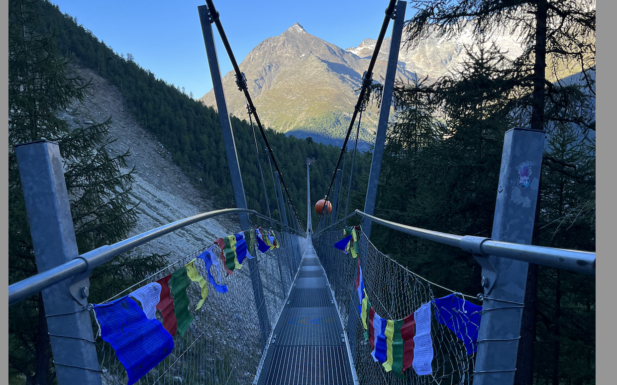
- The Big Highlight: The Charles Kuonen Suspension Bridge. Stretching a massive 494 metres across a deep mountain gorge, it is one of the longest pedestrian suspension bridges in the world. Walking across its open steel grate with the valley floor dropping away beneath your feet is an absolute adrenaline rush, all under the watchful eye of the mighty Matterhorn.
- Culinary Highlight: Zermatter Bier and Fondue. You’ve made it! Once you arrive in car-free Zermatt, celebrate the end of a momentous journey by tucking into a traditional, steaming pot of Swiss cheese fondue, washed down with a cold, locally brewed Zermatter beer.
The Hidden Fact
As you near the end of the trail and Zermatt comes into view, you’ll pass through the tiny, sun-blackened larchwood hamlets of Findeln and Tufteren. Look closely at the small wooden barns raised on stilts. Between the wooden structure and the stone foundations, you’ll see large, circular flat stones. These are “Mauseplatten”—clever architectural tools designed centuries ago to keep mice and rats from climbing up the stilts into the grain stores.
Pop into one of these old hamlets for a well-deserved glass of Swiss wine—you’ve officially conquered the Haute Route!
The hikers Newsletter
Get trekking info and our latest deals.
